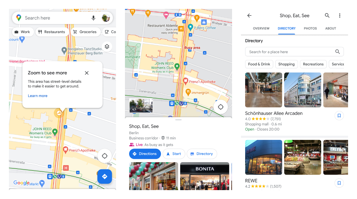
With this feature, you may notice some pulsing round dots in the map with a bar chart icon. Zooming closer will show a more detailed view of the area with crosswalks, side roads and other details. It was a while ago to selected cities and now seems to get wider exposure.
Tapping on the dot specifically will show "Directory" details with a list of nearby places to visit and local search tooling.
In my case, I got it in Berlin that is not listed on Google's Support page. At the same time, I was only able to see the border of the area without a detailed map as per the feature description. The area's directory was called "Shop, Eat, See" and seems to have a different use case in general.
Have you seen it too?
Tester Context:
- 📲 Google Maps is an official Maps and Navigation app by Google.
- 📲 Google Maps is available in beta but lots of new features are rolling out in waves to a limited amount of users.
Google Maps - Apps on Google Play
Real-time GPS navigation & local suggestions for food, events, & activities